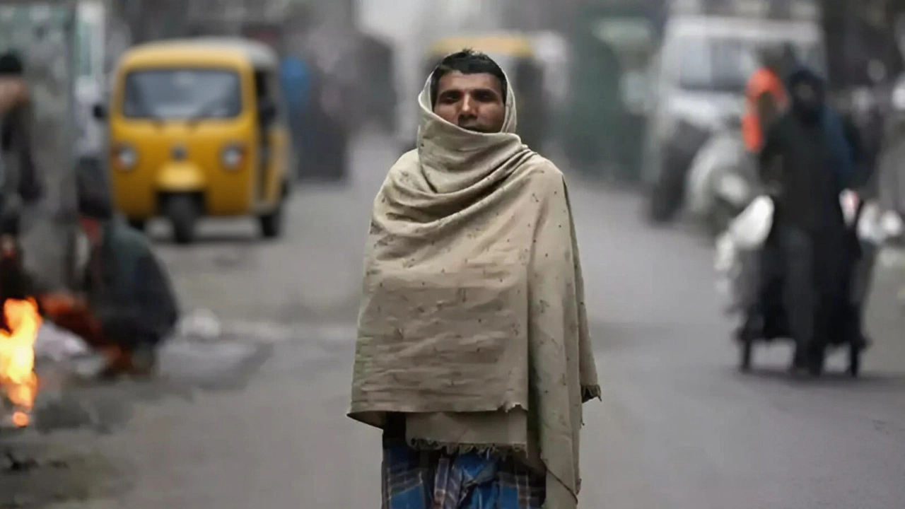
When the first drops of rain fell over Bhopal on October 29, 2025, residents didn’t just reach for umbrellas—they checked their jackets. Cyclone Montha, an unusually late and powerful system, had veered inland from the Bay of Bengal, dumping rain and chilling temperatures across Madhya Pradesh in a pattern no one had seen in decades. By the next day, Bhopal’s high had plunged to 25.2°C (77.4°F), nearly 6°C below its October average. The Indian Meteorological Department had already raised orange and yellow alerts, warning of gusts up to 65 km/h and flash flooding in 20 districts. This wasn’t just a rainy day. It was a meteorological rupture.
What Happened to October in Central India?
October in Bhopal is supposed to be golden—sunny, dry, and comfortably warm. Historically, average highs hover around 31°C (88°F), with just two or three rainy days and total rainfall under 40mm. But in 2025, the pattern collapsed. On October 30, the city recorded its coldest day of the month: a minimum of 17.4°C (63.2°F). That’s not just cool—it’s November weather. In Ujjain, the high barely reached 23°C. In Pachmarhi, it dipped to 24°C. The Indian Meteorological Department confirmed that 20 cities across the state recorded daytime temperatures below 26°C, a phenomenon rarely observed before mid-November.
Meanwhile, rainfall totals skyrocketed. Where Climate-Data.org had projected 24mm of rain for the entire month, actual accumulation hit 58mm by October 31—nearly triple the norm. The Cyclone 'Montha' didn’t make landfall as a major storm, but its outer bands swept across central India with unusual persistence, pulling moisture from the Bay of Bengal long after the monsoon had officially retreated.
Who Was Affected—and How?
The impacts were immediate and widespread. In Khandwa and Betul, flooded roads stranded commuters. Power outages hit 12,000 homes in Jabalpur after wind snapped transmission lines. Schools in Narsinghpur and Chhindwara shut down for two days. Farmers in the Narmadapuram belt reported damaged mustard seedlings, a critical crop planted just weeks earlier.
“We were preparing for dry, warm October,” said Dr. Anjali Mehta, a climate researcher at the Central India Environmental Institute. “But this wasn’t just a late monsoon remnant. The moisture plume from Montha was more intense than any system we’ve tracked since 2002. It’s as if the monsoon refused to leave.”
Even the elderly noticed. “I’ve lived here since 1958,” said 82-year-old Rajesh Verma, sipping chai in a Bhopal park. “I’ve seen droughts, floods, heatwaves. But this? Cold and rainy in October? My knees ache more now than in December.”
The Forecast: Cooling, Then a Slow Return to Normal
For the first time in memory, Bhopal’s weather app showed a 10-day stretch of highs below 30°C. AccuWeather’s data revealed a sharp dip: October 30 (87°F/74°F), October 31 (89°F/72°F), then a gradual climb. By November 10, temperatures were still only at 85°F—unusually low for mid-November. The Indian Meteorological Department predicted a return to typical post-monsoon warmth by November 18, with highs climbing back to 90°F.
But the lingering question remains: Was this a one-off, or a sign of things to come? Climate models from the Indian Institute of Tropical Meteorology show that late-season cyclones like Montha are becoming 40% more likely over the past 15 years due to warming sea surface temperatures in the Bay of Bengal. “We’re not talking about climate change in the future tense anymore,” said Dr. Mehta. “It’s happening in real time, in October, in Bhopal.”

Why This Matters Beyond the Rain
The disruption isn’t just about comfort. Bhopal’s energy grid, designed for peak summer cooling and mild winters, struggled to adjust. Power demand spiked as residents turned on heaters—something unheard of in October. Public health centers reported a 32% increase in respiratory cases, particularly among children and the elderly. The city’s water reservoirs, already low after a dry summer, saw a sudden 18% refill—useful, but too late for most crops.
And then there’s tourism. October is prime season for visitors to Bhopal’s lakes and historical sites. This year, bookings dropped 27% as travelers canceled due to weather uncertainty. “We had 400 rooms booked for the first weekend,” said hotel owner Meena Patel. “We got 120. The rest said, ‘It’s supposed to be sunny in India—why is it raining?’”
What’s Next?
The Indian Meteorological Department has extended its monitoring window through mid-November. Officials are now preparing for a second possible system—dubbed “Montha-2”—that could form in the Arabian Sea by late November. Meanwhile, the state government has launched a “Climate Resilience Task Force” to reassess infrastructure standards, emergency response protocols, and agricultural advisories for the post-monsoon window.
For now, the skies are clearing. The wind has calmed. But the memory of that cold, wet October lingers. And for many, it’s no longer just weather. It’s a warning.
Frequently Asked Questions
Why was Cyclone 'Montha' so unusual for October?
Cyclone 'Montha' formed far later than typical for the region—most cyclones in the Bay of Bengal dissipate by mid-October. Its persistence and inland trajectory were fueled by unusually warm sea temperatures (29.5°C, 2°C above average) and weak upper-level winds, allowing it to maintain structure longer than usual. Historical data shows such late-season cyclones occurred only twice in the last 50 years.
How did temperatures in Bhopal compare to historical averages?
Bhopal’s October 2025 average temperature was 25.3°C, matching the 30-year norm, but the distribution was extreme. While early October highs hit 31°C, late-month readings plunged to 17.4°C at night—the coldest October low since 1987. The daily range exceeded 12°C for 11 consecutive days, far beyond the typical 6–8°C variation. This volatility stressed crops, power systems, and public health infrastructure.
What caused the heavy rainfall in a typically dry month?
Cyclone 'Montha' acted as a moisture pump, drawing humid air from the Bay of Bengal into central India. Unlike typical post-monsoon systems that fizzle out, Montha’s slow movement and interaction with a residual low-pressure zone over Madhya Pradesh caused prolonged, localized downpours. Rainfall in some districts exceeded 120mm in 72 hours—equivalent to a month’s average. This was not monsoon rain—it was cyclonic moisture redistribution.
Are such events becoming more common in India?
Yes. A 2024 study by the Indian Institute of Science found that post-monsoon cyclones impacting central India have increased by 65% since 2000. Warming oceans, changing jet stream patterns, and reduced wind shear are creating conditions where cyclones can survive longer and travel farther inland. Experts now classify October–November as a “secondary cyclone season,” not just a transition period.
What should residents do if similar weather happens again?
Residents should monitor Indian Meteorological Department alerts via the ‘Mausam’ app, keep emergency kits ready (including warm clothing, medicines, and batteries), and avoid flooded areas—even if rain seems light. Urban drainage systems in Bhopal are outdated; a few inches of rain can cause major flooding. Local authorities now recommend preparing for cyclone-like conditions from mid-October through mid-November.
Will this affect next year’s weather patterns?
It’s too early to say definitively, but scientists are watching for a “memory effect” in soil moisture and atmospheric circulation. Wet October soils can delay the onset of winter chill, potentially pushing cold waves into December. Conversely, if November remains dry, the stored moisture could fuel early monsoon activity next year. Climate models suggest this pattern may repeat every 2–3 years, making long-term planning essential.