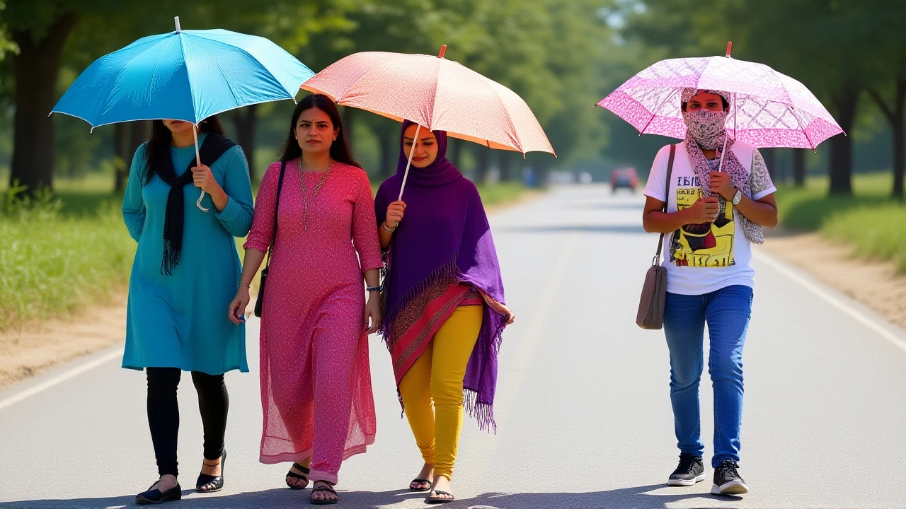
It’s a country torn in two by the sky. While millions in northern and central India are baking under severe heatwaves, residents in the northeast and east are battling heavy rains, hail, and lightning. The India Meteorological Department (IMD) has issued a stark nationwide alert for late May, describing an "extreme contrast" in weather patterns that is testing infrastructure and public safety across the subcontinent.
The warning covers the period from May 25 to May 31. It’s not just a mild shift in seasons; it’s a volatile mix of dangerous temperatures and unstable atmospheric conditions. Here’s what you need to know before stepping outside.
A Tale of Two Weathers
The IMD’s bulletin paints a picture of meteorological whiplash. On one side, you have the scorching dry heat gripping the north and center. On the other, you have the pre-monsoon chaos of thunderstorms and squalls in the east and south.
In West Rajasthan, heat wave conditions are expected to intensify at isolated locations. Meanwhile, just a few hundred kilometers away, parts of Uttar Pradesh and Madhya Pradesh are bracing for thunderstorms with gusty winds reaching 40–50 kmph. This isn’t unusual for the season, but the intensity and simultaneous occurrence of these extremes make this week particularly hazardous.
"The atmosphere is highly unstable," explains Dr. Rajesh Kumar, a climatologist based in New Delhi. "When you have such sharp gradients between hot, dry air masses and moist, turbulent systems, you get violent convection. That means lightning strikes, sudden downpours, and sometimes hail."
Storms Sweep the East and Northeast
If you’re in the northeastern states, pack your umbrella—and maybe a helmet if hail is forecast. The IMD predicts fairly widespread light to moderate rainfall accompanied by thunderstorms and lightning over Assam, Meghalaya, Nagaland, Manipur, Mizoram, and Tripura between May 25 and May 27.
Isolated heavy rainfall is also likely in these regions, along with the Andaman and Nicobar Islands, Kerala, and Lakshadweep. In Sub-Himalayan West Bengal and Sikkim, the storms are expected to linger until May 28.
The danger here isn’t just rain; it’s wind. Thundersqualls—defined as strong downdrafts causing straight-line winds—are forecast with speeds reaching 50–60 kmph, gusting up to 70 kmph. These are scheduled for Gangetic West Bengal (May 27–29), Bihar (May 26–29), Jharkhand (May 26–27), and Odisha (May 25 and 29). For farmers and commuters, these squalls can cause immediate damage to crops and disrupt transport networks.
Southern India: Humidity and Hail
Down south, the story is equally complex. Kerala and Lakshadweep will see widespread light to moderate rain with thunderstorms through May 29. But it’s not all wet weather.
Coastal areas of Tamil Nadu, Puducherry, and Karaikal are under a heat and humidity warning. The combination of high temperatures and moisture creates a oppressive "wet bulb" effect, making it feel hotter than the thermometer reads. In Tiruchirappalli, temperatures recently spiked to a staggering 105°F (40.5°C).
Oddly enough, even in the south, storms are on the menu. Interior Karnataka, Telangana, and Rayalaseema face isolated thunderstorms with gusty winds. North Interior Karnataka has a specific alert for isolated hailstorm activity on May 27. Hail might sound minor, but golf-ball-sized ice pellets can shatter car windows and damage roofs in minutes.

Northwest and Central Regions
The northwest is seeing a mixed bag. While West Rajasthan burns, Delhi, Punjab, Haryana, and Chandigarh could see isolated light to moderate rain with thunderstorms. East Uttar Pradesh is flagged for similar activity on May 27, while Rajasthan sees potential storms on May 28–29.
In central India, Chhattisgarh faces thunderstorms from May 25–29. Vidarbha and Madhya Pradesh are expected to see activity later in the week, from May 28–31. These pre-monsoon showers are crucial for agriculture, but the accompanying lightning poses a significant risk to rural communities.
What This Means for You
This isn’t just data on a map; it’s about daily survival and planning. Power grids in heatwave zones are under strain due to increased AC usage. Meanwhile, storm-prone areas face risks of waterlogging and flight delays.
Experts advise keeping emergency kits ready. In storm zones, secure loose outdoor objects and avoid standing near tall trees during lightning. In heatwave zones, stay hydrated and limit outdoor exposure between 12 PM and 4 PM. The IMD urges citizens to monitor local updates closely, as conditions can change rapidly.
Frequently Asked Questions
Which areas are most affected by heatwaves?
Severe heatwave conditions are primarily affecting northern and central India, with West Rajasthan facing intensified heat. Coastal Tamil Nadu, Puducherry, and Karaikal are experiencing dangerous combinations of heat and high humidity, with Tiruchirappalli recording highs of 105°F.
What are thundersqualls and where are they expected?
Thundersqualls are intense thunderstorms with strong downdrafts causing wind speeds of 50–60 kmph, gusting to 70 kmph. They are forecast for Gangetic West Bengal, Bihar, Jharkhand, and Odisha between May 25 and May 29, posing risks to structures and travel.
Is hailstorm activity expected anywhere?
Yes, isolated hailstorm activity is specifically forecast for North Interior Karnataka on May 27. Hail can cause significant damage to vehicles and property, so residents in this area should secure outdoor items and avoid unnecessary travel during storm peaks.
How long will these weather conditions last?
The IMD alerts cover the period from May 25 to May 31. However, specific events like thundersqualls in East India or heatwaves in Rajasthan may persist beyond this window as the monsoon onset approaches. Continuous monitoring of local forecasts is essential.
Why is there such a contrast in weather across India?
This extreme contrast is typical of the pre-monsoon season. Hot, dry air masses dominate the north and center, while moist air from the Bay of Bengal interacts with landmasses in the east and south, creating instability, thunderstorms, and heavy rainfall. This dynamic often leads to volatile weather patterns.